Restored coastal tower
It stands in Corsano about 330 m from the sea and around 130 m above sea level.
One of the best-known viewpoints on the Salt Routes.
A restored coastal tower on the plateau above Marina Guardiola, a scenic stop on the Salt Routes and a landmark in Corsano’s 16th-century defence system.
The tower is much easier to read than Torre del Ricco, but what survives is mainly the restored and altered battered base. The recovered complex has hosted tourism and cultural activities, but we do not promise daily indoor opening without a current official timetable.
It stands in Corsano about 330 m from the sea and around 130 m above sea level.
One of the best-known viewpoints on the Salt Routes.
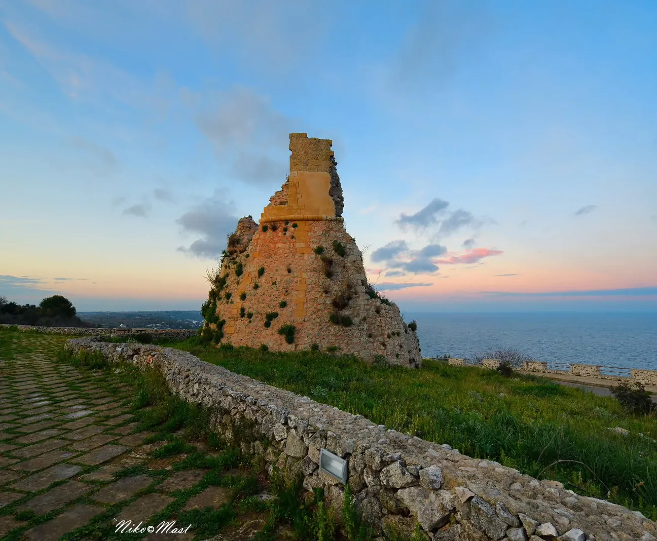
Municipal history places it in Corsano’s coastal defence system; specialist sources suggest construction around 1563.
A 1584 record mentions 217 ducats spent on the tower.
What survives is mainly the battered base to the stringcourse; external stairs and other elements are later.
It should not be described as perfectly preserved in its original form.
The complex includes a recovered 20th-century barracks used during the World Wars.
The site tells more than one period.
The recovered complex has been used for visitor information, environmental education and events.
Activities are periodic; check before planning an indoor visit.
The Regional Park itinerary reaches Torre Specchia Grande and identifies it as a scenic rest point.
Use official tracks for longer routes.
It communicated with Torre Nasparo to the north and Torre del Ricco to the south.
The three towers explain the historic warning chain.
Easier to appreciate than the ruined cliff towers as a scenic cultural stop.
Still a rural walking environment, not a playground.
No dedicated car park or fully accessible route is claimed without current specific evidence.
Check access and event arrangements for mobility needs.
Comfortable shoes, water, hat, sunscreen and a charged phone for the Salt Routes.
Check any opening before planning an indoor visit.
Reference map coordinates: 39.8795756, 18.3948689.
The gallery shows the available and verified photographs for this place.
Have you photographed this beach or a beach club located here? Send your image to Salentissimo.it.
The photo and the details you enter will be emailed to the editorial team and checked before possible publication among the photographs of this beach.
Do you own or manage a beach club or bathing establishment? Claim your listing free of charge: email us a photo, a short description, your contact details and a link to your website. We will create an updated card with the information you provide.
Continue along the same coast with the linked guides.
A cove or bay on the coast of Corsano, set within the local rocky or sandy landscape.
Open guideA beach or sea-access point on the coast of Corsano, included among the public coastal places of this page.
Open guideA cove or bay on the coast of Corsano, set within the local rocky or sandy landscape.
Open guideA historic coastal tower or lookout connected with the defensive landscape of Corsano.
Open guideA coastal place documented in the Salentissimo.it archive for Corsano.
Open guideDo you run a hotel, B&B, residence, holiday home or other accommodation? Claim your listing free of charge: email us a photo, a short description, your contact details and a link to your website. We will create an updated card with the information you provide.
Return to Corsano or continue towards Marina di Novaglie and Marina di Tiggiano.
Location, history, access, safety and practical advice.